Updated on November 19, 2024
Unveil the Hidden Waterfalls Near Portland, Oregon
Exploring The Waterfalls Around Portland
The area surrounding Portland, Oregon is a haven for waterfall enthusiasts, offering a diverse range of spectacular falls just a short drive from the city. Whether you’re a seasoned hiker or looking for a leisurely day trip, these waterfalls near Portland provide serene escapes into nature and jaw-dropping views.
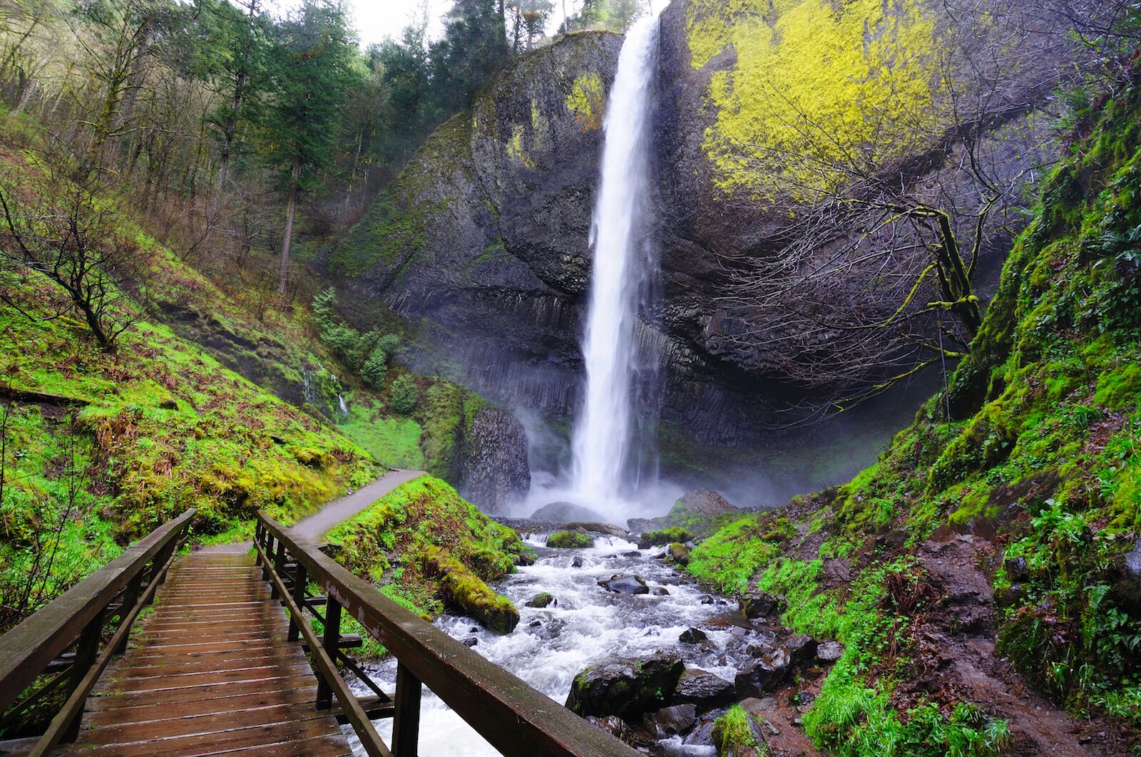
From towering cascades to gentle, flowing streams, each of these waterfalls allures with its own distinct charms. Within the Columbia River Gorge National Scenic Area, in particular, which is known for its lush forests and dramatic cliffs, some notable mentions include the iconic Multnomah Falls and the lesser-known but equally captivating Latourell Falls and Horsetail Falls.
Closest Waterfalls to Portland
For those short on time or seeking a quick nature getaway, the closest waterfalls to Portland are ideal. Just a brief drive from the city, these falls provide a perfect escape into Oregon’s natural beauty. The closest includes the picturesque Bridal Veil Falls, which is also in the Gorge, and is a mere 30-minute drive from downtown.
Portland Waterfall Hikes
Hiking enthusiasts will find paradise just outside the Portland area, with numerous trails leading to the various falls. Popular Portland waterfall hikes include the Eagle Creek Trail, which leads to the mesmerizing Punch Bowl Falls, and the Wahkeena Falls Loop, offering multiple views of additonal falls along the trail.
Best Waterfalls Near Portland
The best waterfalls near Portland display their own individual alluring charms and are consistently rated among the top natural attractions in the region. Head on out and see which ones you enjoy the most.
Multnomah Falls
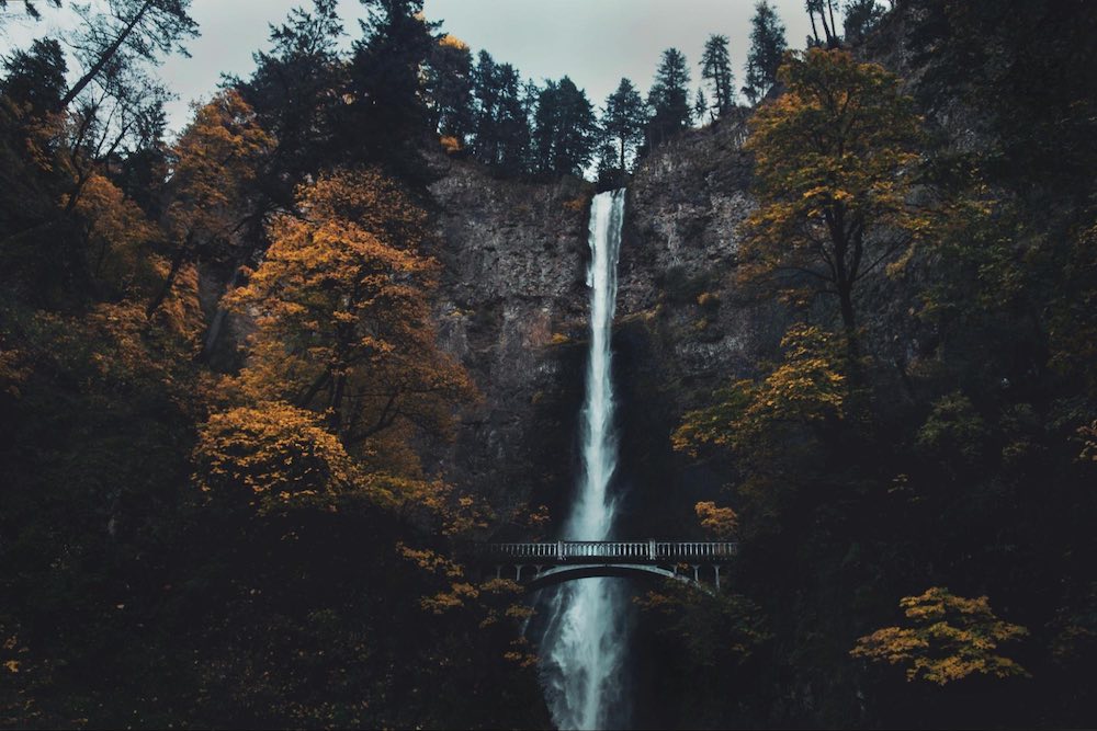
One cannot mention Portland waterfalls without highlighting Multnomah Falls. This 620-foot, two-tiered wonder is one of the tallest in the United States as well as the most-visited attraction in the Columbia River Gorge National Scenic Area. Visitors can enjoy a short hike to the Benson Bridge for an up-close view or take the more challenging trail to the top for panoramic vistas.
While Multnomah Falls typically takes center stage for visitors adventuring into the Gorge from Portland, there are numerous other lesser-known yet nevertheless sensationally beautiful waterfalls near Portland that deserve your attention. These treasures are tucked away not only in the Gorge’s verdant forests but a bit beyond, as well, offering intimate encounters with nature’s splendor. Here’s a guide to some of these falls, all within a short drive from Portland.
Wahkeena Falls & Fairy Falls
Named after the native Yakama word for “most beautiful,” the 242-foot Wahkeena Falls lives up to its name with its comely, two horsetail-shaped drops.
Starting just a half-mile west of Multnomah Falls, the 2.8-mile Wahkeena Trail up to it takes you through a series of scenic switchbacks before delivering you to close-up views of its display. It is well-marked and relatively easy, however, making it accessible for hikers of all skill levels. Along the way you’ll be treated to diverse flora and fauna, including colorful wildflowers in the spring and summer months.
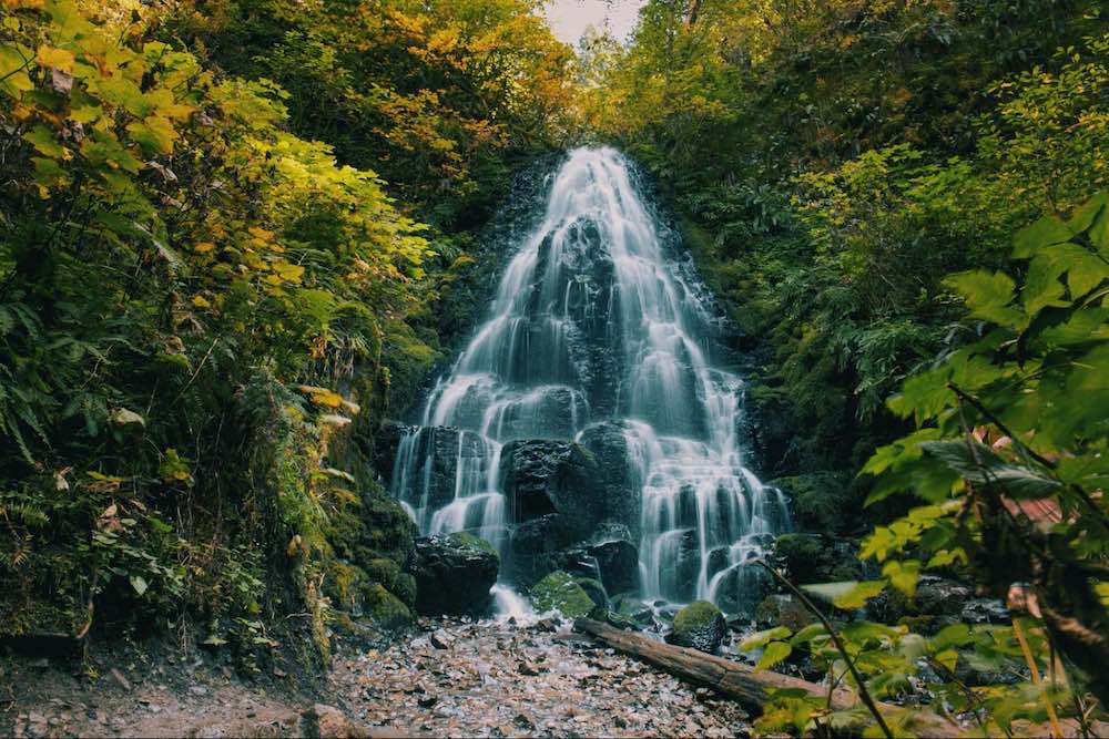
A mile up the trail, you’ll encounter Fairy Falls, a delicate 20-foot waterfall that fans out over mossy rocks. The surrounding area is dense with ferns and other greenery, providing a peaceful escape from the busier parts of the trail.
Continuing along the trail, you’ll reach a stone bridge above Wahkeena Falls. This bridge is a highlight of the hike, serving up sweeping views of the falls and the surrounding gorge. This vantage point also allows you to appreciate the full scale and beauty of Wahkeena Falls as it cascades down the cliffside. It’s also a great spot to take a break and enjoy the scenery before continuing your hike.
Although Wahkeena is less crowded than Multnomah, it’s still advisable to start your hike early to enjoy some solitude. For those looking to extend their adventure, the Wahkeena Trail connects to several other trails in the Columbia River Gorge, including the Multnomah-Wahkeena Loop. This loop trail provides access to other ravishingly gorgeous falls and scenic viewpoints, as well, making it a perfect choice for a day-long hiking excursion.
Whether you’re a long-time hiker or just looking for a leisurely walk in nature, Wahkeena Falls and Fairy Falls offer a perfect blend of accessibility, beauty, and serenity.
Ponytail Falls
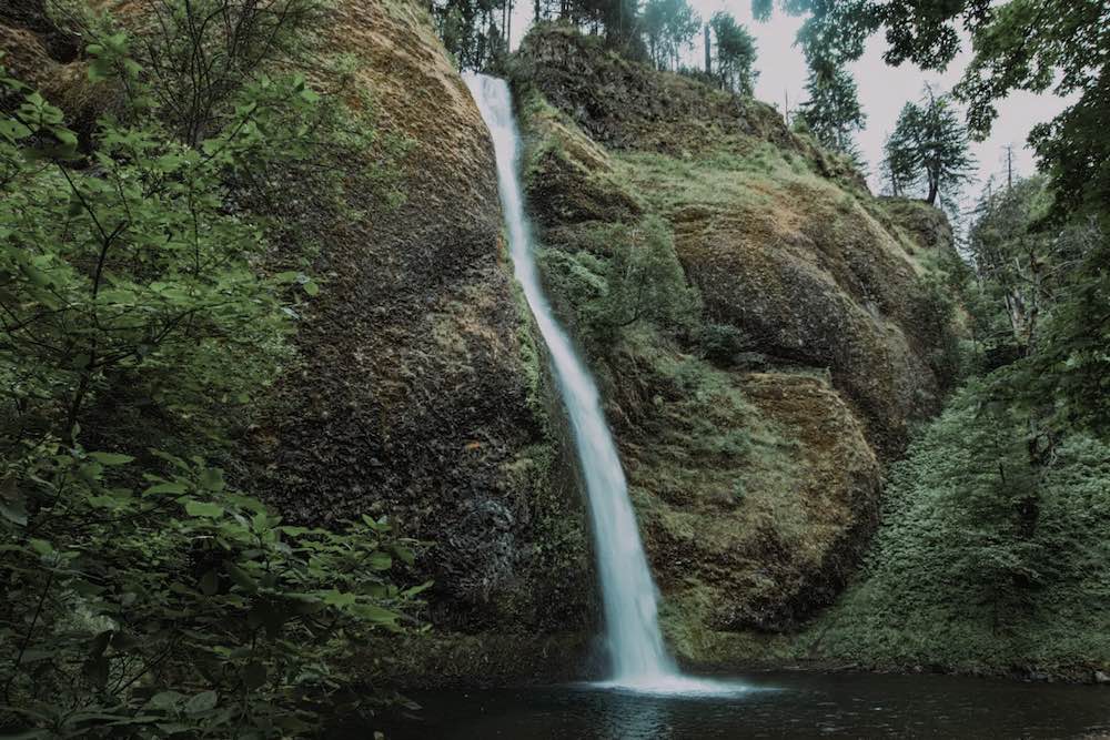
Don’t let the name deceive you — Ponytail Falls is truly awe-inspiring. Also known as Upper Horsetail Falls, and located less than half a mile up the Horsetail Falls Trail, this 88-foot splendor drops into an imposing amphitheater-like basin. The trail even passes behind the falls, allowing a unique and close-up perspective from a rocky alcove.
The easy 0.8-mile round-trip hike leading to it is begins at the base of Horsetail Falls, another beautiful 214-foot waterfall, and is easily accessible from the Historic Columbia River Highway, making it a convenient stop for those exploring the Gorge.
The trail is well-maintained and allows hikers a chance to immerse themselves in the natural beauty of the area, with opportunities to see various native plants and wildlife.
Combining Ponytail and Horsetail Falls makes for a quick and rewarding adventure. For the best experience, visit on a weekday morning.
In addition to the scenic beauty, the hike to Ponytail Falls lends itself as an escape from the commotion of everyday life. The steady gushing of the water, the cool mist in the air, and the brilliant greenery cast a peaceful and rejuvenating thrall.
This waterfall is a favorite among photographers, who often capture lovely images of it from different angles, especially from behind the waterfall, where the view is particularly dramatic.
Whether you are an experienced hiker or just looking for a leisurely walk in nature, Ponytail Falls calls with its perfect blend of accessibility and quietude. Bring a camera!
Elowah Falls & Upper McCord Creek Falls
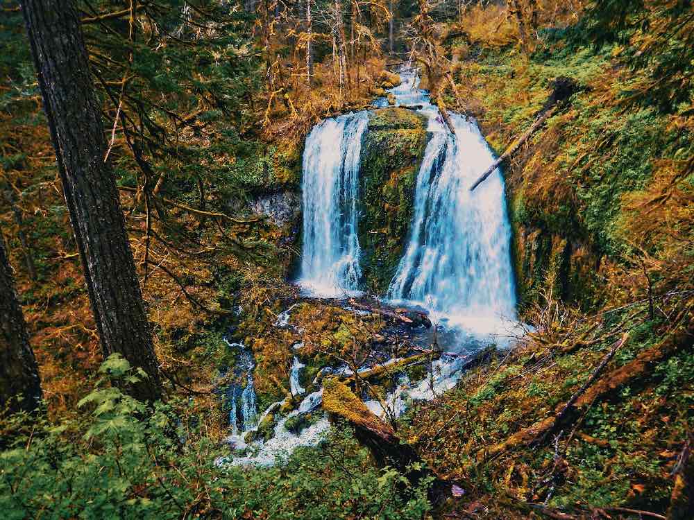
Plunging 213 feet into an enormous amphitheater lined with columnar basalt, Elowah Falls is one of the most dramatic waterfalls in the Gorge. The force of the water creates a constant mist, nourishing the luminous green mosses and ferns on the cliffs. Despite its striking display, however, it sees far fewer visitors than Multnomah.
The falls is located in the John B. Yeon State Scenic Corridor, which is part of the larger Columbia River Gorge National Scenic Area. This area is rich in geological history, with the basalt cliffs formed by ancient volcanic activity. The 1.5-mile round-trip hike to the falls is steep but rewarding, leading you through a deep forest onto awesome views of the waterfall as well as a diverse array of plant and animal life before opening up at the falls’ base. The trail is relatively quiet, providing a peaceful escape from more crowded tourist spots.
For a longer adventure, continue up the trail to see the wispy, often overlooked but equally enchanting Upper McCord Creek Falls. The hike to this secondary waterfall involves a bit more effort, but the payoff is worth it. As you ascend, you’ll be treated to expansive views of the Columbia River and the surrounding Gorge. The trail passes through soaring old-growth Douglas firs along with a haven of luxuriant understory plants.
Both Elowah Falls and Upper McCord Creek Falls are excellent destinations for photographers, offering a variety of perspectives and compositions. The mist from the falls often creates rainbows on sunny days, adding a magical touch to your visit.
For those interested in geology, the columnar basalt formations around Elowah Falls make a fascinating sight. These formations are a result of lava cooling and cracking in a distinct pattern, creating hexagonal columns that are uniquely arresting.
Other Must-See Waterfalls
(Note: Parking at the trailhead to these falls may require a pass.)
Latourell Falls
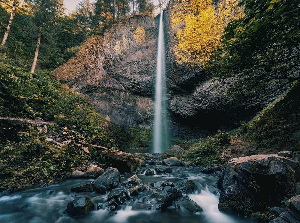
Known for its striking 249-foot plunge over columnar basalt formations, yet easily accessible via a short hike from the parking area, Latourell Falls exhibits the distinctive geology of the Gorge.
Located in Guy W. Talbot State Park, which is part of the National Scenic Area, Latourell Falls is one of the closest major waterfalls to Portland, making it a popular destination for both locals and tourists. They are named after Joseph Latourell, a prominent settler in the area during the 19th century.
The hike to Latourell Falls is relatively short and suitable for families and casual hikers. The well-maintained trail winds through a lush forest of Douglas fir, western red cedar, and bigleaf maple, extending a shaded and pleasant walk. As you approach the falls, you’ll be greeted by the sight of water cascading over a sheer basalt cliff.
One of the unique features of Latourell Falls is the columnar basalt formations that frame them. These hexagonal columns were formed by ancient volcanic activity, and their distinctive dark shapes contrasting against the vibrant surrounding greenery adds to the geological interest of the site.
For those looking to explore further, the trail continues beyond the lower falls to a viewpoint that offers views of the upper falls. Though less frequently visited, these falls are equally beautiful and provide a more secluded experience. The trail also connects to other nearby trails, allowing for longer hikes and more exploration of the area.
The surrounding park area is equipped with picnic facilities, making it a great spot for a day trip. Visitors can enjoy a meal while taking in the scenic views of the falls and the Gorge. In addition, the park is a habitat for a variety of wildlife, including birds, deer, and other native species, providing opportunities for nature observation and birdwatching.
Sheppard’s Dell Falls
Nestled in a lush, verdant canyon, Sheppard’s Dell Falls is a picturesque 120-foot waterfall that can be reached by a short, well-maintained trail. This waterfall is perfect for a quick stop as well as ample opportunities for photography and enjoying the serene surroundings.
Located within the Shepperd’s Dell State Natural Area, a scenic spot along the Historic Columbia River Highway, this waterfall is named after George Shepperd, who donated the land to the state in memory of his wife. The falls cascade down a series of basalt rock steps, creating a multi-tiered effect.
The short trail to Sheppard’s Dell Falls is easily accessible and suitable for visitors of all ages and abilities. The trailhead is located just off the highway, making it a convenient stop for travelers exploring the Columbia River Gorge. As you walk along the trail, you’ll be surrounded by an abundance of vegetation, including ferns, mosses, and high-reaching trees.
One of the highlights of visiting Sheppard’s Dell Falls is the stone arch bridge that spans the canyon. Built in the early 20th century, this historic bridge is a beautiful example of early highway engineering while serving as a vantage point from which to view the falls and the surrounding landscape.
The natural area around Sheppard’s Dell Falls is home to a variety of wildlife, including birds, small mammals, and amphibians. The cool, shaded environment provides an ideal habitat for these creatures, and visitors may be lucky enough to spot some during their visit. The area is also known for its colorful wildflowers in the spring and summer.
Bridal Veil Falls
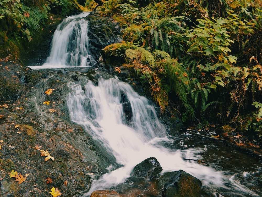
A 120-foot waterfall that’s also easily reached by a short, well-maintained trail, Bridal Veil Falls is another must-visit. This two-tiered jewel is surrounded by glistening moss and ferns, creating a magical, almost otherworldly atmosphere.
Bridal Veil Falls is located within the Bridal Veil Falls State Scenic Viewpoint, a small but enchanting park in the Gorge. The park is easily accessible from the Historic Columbia River Highway, making it a convenient stop for those exploring the area.
The waterfall itself consists of two distinct drops over the basalt rock formations, creating a large cascading effect. The upper drop is about 60 feet, followed by a lower drop of 40 feet, combining to form the total 120-foot height. Ferns, mosses, and wildflowers thrive in the moist environment created by the falls.
In addition to the forested trail meandering to the base of the falls, there is also an upper viewpoint accessible from the parking area. This viewpoint opens onto the Gorge and the Columbia flowing slowly through it, contrasting against the powerful waterfall.
The park’s picnic areas and restrooms make it a great spot for an outing or leisurely day trip. Visitors can enjoy a picnic while listening to the soothing sounds of the waterfall and taking in the natural beauty of the surroundings.
For those interested in history, the nearby Bridal Veil Post Office is one of the smallest operating post offices in the United States and offers a charming glimpse into the past. The area around Bridal Veil Falls has a rich history, with remnants of old logging operations and the historic Columbia River Highway adding to the allure of the location.
Triple Falls
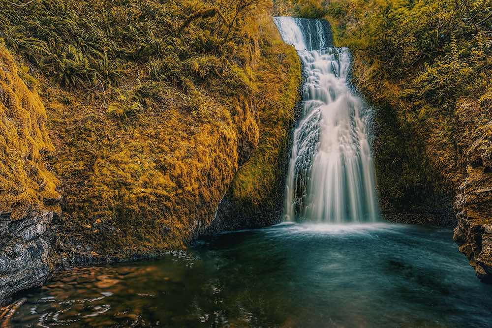
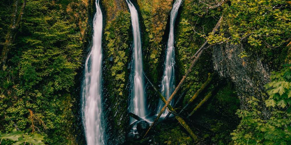
This unusual waterfall features three distinct streams cascading down 120 feet. A moderate scenic 2-mile hike will take you to this outstanding spot where you can enjoy the tranquil sound of rushing water and the beauty of the surrounding forest.
The trail begins at the Oneonta Gorge trailhead, which is easily accessible from the Historic Columbia River Highway. As it follows Oneonta Creek, the hike is moderately challenging, with a steady incline and several switchbacks, but the effort is well worth it for the rewarding setting at the end.
As you hike, you’ll pass through a forest filled with ferns, moss-covered trees, and an array of wildflowers, especially during the spring and early summer. Along the way, you’ll encounter several smaller waterfalls and pools, offering plenty of opportunities for photos and rest stops.
When you reach Triple Falls, you’ll be greeted by the sight of three parallel streams of water plunging over a rocky cliff. The falls are especially enchanting after a period of heavy rain, when the water flow is at its peak.
The trail does not end at Triple Falls; adventurous hikers can continue on to explore further into the Gorge, as the area is part of a network of interconnected trails, allowing for longer hikes. For those interested in geology, the exposed rock formations around Triple Falls provide a glimpse into the volcanic history of the Gorge.
In addition to its natural beauty, Triple Falls is also a habitat for a variety of wildlife. Birdwatchers may spot species such as the American dipper, which is known to frequent the creek, or catch sight of other native birds and animals that call this area home.
Wahclella Falls
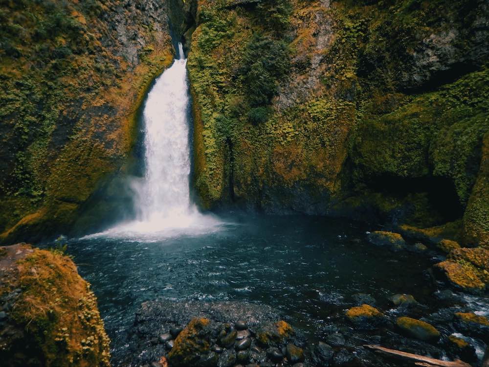
A beautiful 2-mile round-trip hike meanders through a leafy canyon that leads you to Wahclella Falls, a powerful two-tiered waterfall that crashes down 350 feet, making it one of the more alluring ones in the Gorge. The falls themselves are a magnificent sight, especially in the spring when water flow is at its peak.
The trailhead for Wahclella Falls is situated near the Bonneville Dam, and the trail follows Tanner Creek as it winds through the canyon. The path is well-maintained and features several footbridges and viewpoints of the creek and surrounding forest.
The hike begins with a gentle ascent through a shaded forest of Douglas firs and bigleaf maples. As you progress, the sound of rushing water accompanies as you encounter a variety of native plants, including ferns, mosses, and wildflowers, which thrive in the moist, cool environment.
Wahclella Falls’ two main drops consist of an upper falls that cascades into a pool, followed by a voluminous lower falls that plunges into a deep, rocky basin.The lower falls, in particular, is known for its dramatic flow, especially during the spring melt when water levels are at their highest.
At the base of the lower falls, there is a spacious area where visitors can relax and take in the scenery. The pool at the bottom of the falls is surrounded by moss-covered boulders and thriving vegetation.
The trail to Wahclella Falls also offers opportunities to observe local wildlife. Birds such as dippers and kingfishers can often be seen along the creek, and the dense forest and diverse ecosystem of the canyon provides habitat for various mammals and amphibians.
For those looking to extend their hike, the Wahclella Falls Trail connects to several other trails in the Columbia River Gorge, providing additional routes for exploration.
Punch Bowl Falls
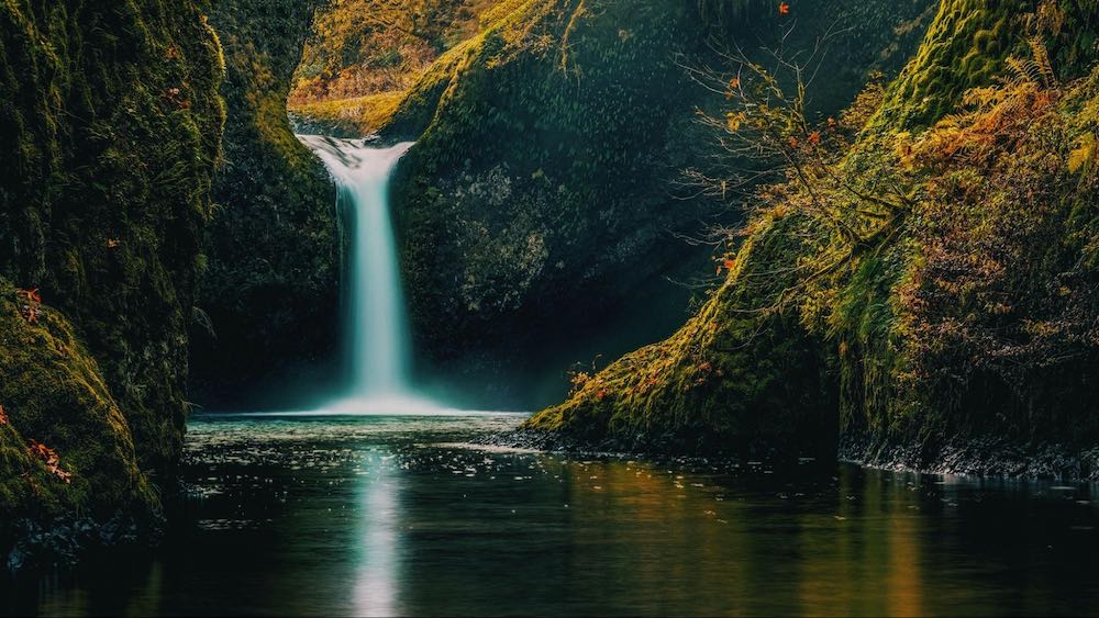
Located along Eagle Creek, Punch Bowl Falls is one of the most iconic waterfalls in the Columbia River Gorge, its name having been derived from the bowl-shaped pool into which the water plunges.
The hike to this waterfall and views of the surrounding canyon and river is a 4-mile round trip, and it starts at the Eagle Creek trailhead, located off the Historic Columbia River Highway, just before the town of Cascade Locks and the exit to the Bridge of the Gods. Renowned for its dramatic scenery, the Eagle Creek Trail is one of the most popular hiking trails in the region.
The trail follows the course of Eagle Creek, winding through a narrow canyon with steep cliffs and numerous waterfalls along the way.
As you hike to the falls, you’ll traverse a well-maintained path that includes sections with handrails and cable supports for safety. The trail passes several viewpoints where you can stop and admire the surrounding landscape. Along the way, you’ll also pass by smaller waterfalls, such as Metlako Falls and Lower Punch Bowl Falls, each offering its own unique beauty.
The hike is relatively moderate, and the forested surroundings provide ample shade as the sound of rushing water accompanies you throughout the journey. The final descent to the base of Punch Bowl Falls involves a short, steep scramble, but the effort is well worth it for the view of the falls up close.
The falls is a visual delight with its natural amphitheater surrounded by massive basalt cliffs, abundant greenery, and the crystal-clear pool at its base. It’s also a popular spot for swimming and wading in order to cool off after a hike during the warmer months.
For photographers, Punch Bowl Falls offers a variety of compositions and lighting conditions to capture its charm. If you’re looking for a longer hike, the Eagle Creek Trail continues beyond Punch Bowl Falls and connects to several other trails in the Gorge.
Dry Creek Falls
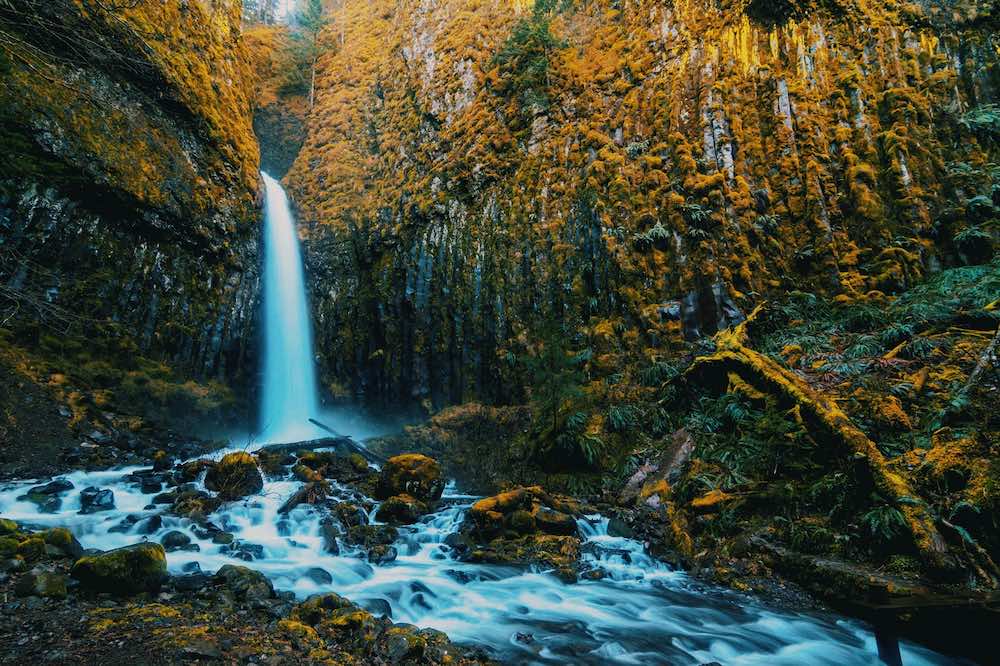
A 4.4-mile round-trip hike through the Pacific Crest Trail brings you to this less-crowded 75-foot waterfall. The trail follows an old roadbed and passes through a deep forest, making it a pleasant and relatively easy hike.
The hike to Dry Creek Falls begins at the Bridge of the Gods trailhead in Cascade Locks, which is a part of the renowned Pacific Crest Trail (PCT). The PCT is a long-distance hiking and equestrian trail that stretches from the Mexican border all the way to the Canadian border, taking hikers through diverse ecosystems along the way.
As you embark on the hike, you’ll follow a well-marked path that gently ascends through a dense forest of Douglas firs, maples, and cedars. The trail is wide and relatively smooth, making it suitable for hikers of all ages and abilities. Along the way, you’ll cross a few small streams and see an array of wildflowers and ferns that thrive in the moist, shaded environment.
The trail’s historical significance adds an interesting dimension to the hike. It follows an old roadbed that was once used for logging and transportation in the early 20th century. Remnants of this history, such as old bridge abutments and stone structures, can still be seen along the trail, providing a glimpse into the area’s past.
When you reach Dry Creek Falls, you’ll be greeted by the sight of water cascading down a steep basalt cliff into a clear pool below. The 75-foot waterfall is particularly striking after periods of rainfall, when the water flow is at its peak.
For those looking to extend their adventure, the Pacific Crest Trail continues beyond Dry Creek Falls. Hikers can choose to venture further into the forest or return to Cascade Locks to explore the charming town and its amenities.
Starvation Creek Falls
This 190-foot cascade down a steep basalt cliff is located within the Starvation Creek State Park, a small but beautiful spot situated along the Historic Columbia River Highway, and its base is easily accessible by a short and well-maintained trail from the Starvation Creek Trailhead. The falls are especially beautiful in the spring and early summer when the water flow is at its peak.
The park is named after a group of train passengers who were stranded in the area during a snowstorm in the late 19th century.
In addition to Starvation Creek Falls, the park provides easy access to this and several other scenic falls that can be accessed via connected trails. These include Cabin Creek Falls, Lancaster Falls, and Hole-in-the-Wall Falls. The interconnected trail system provides opportunities for longer hikes and exploration of the surrounding area.
The park is equipped with picnic tables and restrooms, making it a convenient spot for a leisurely lunch or a family outing. It’s also a great starting point for exploring the larger Gorge area. Nearby attractions include the scenic vistas of the Columbia River, numerous other waterfalls, and the historic highway itself, which gives a glimpse into the region’s rich history and natural beauty.
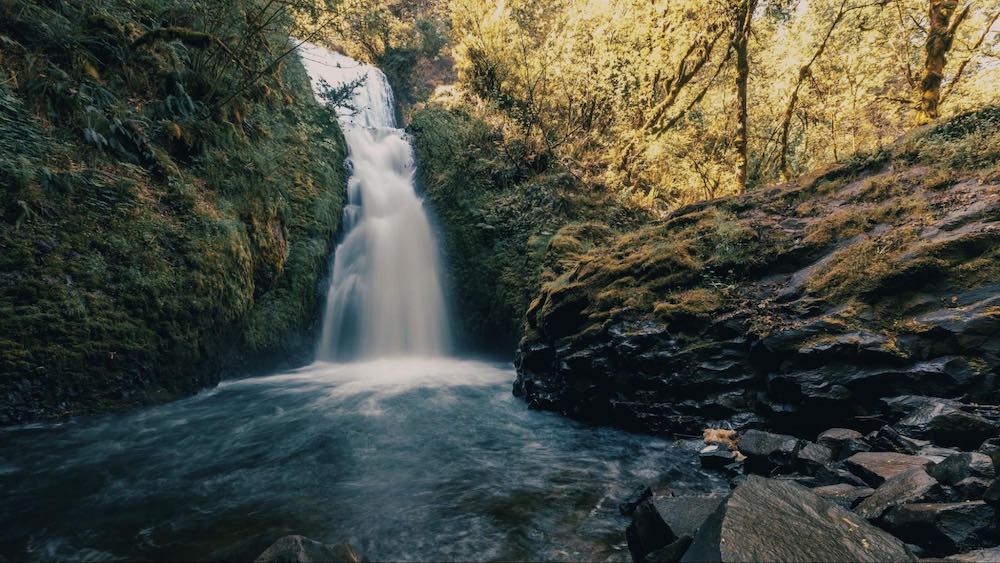
Further Afield
Tunnel Falls
Tunnel Falls is yet another spectacular waterfall located along the Eagle Creek Trail. The falls drop 160 feet, and the trail passes behind the waterfall through a tunnel carved into the rock.
The hike to these falls is a moderately challenging 6 miles one way, making for a 12-mile round trip, and it passes several other waterfalls, including Punch Bowl Falls, Metlako Falls, and Loowit Falls.
The trail is well-maintained but can be challenging in certain sections. Hikers will traverse narrow paths carved into the cliffside, often with steep drop-offs to one side. Safety cables are installed along the more precarious sections to provide additional security.
Tunnel Falls and the Eagle Creek Trail are home to a variety of wildlife. Hikers may spot deer, elk, and numerous bird species, including the elusive American dipper, which can often be seen foraging along the creek. The area is also rich in plant life, with ferns, mosses, and wildflowers adorning the trail and the canyon walls.
For those seeking a longer adventure, the Eagle Creek Trail continues beyond Tunnel Falls, leading to more remote and less-visited areas of the Columbia River Gorge. The trail eventually connects to the Pacific Crest Trail, providing even more opportunities for extended hikes and exploration.
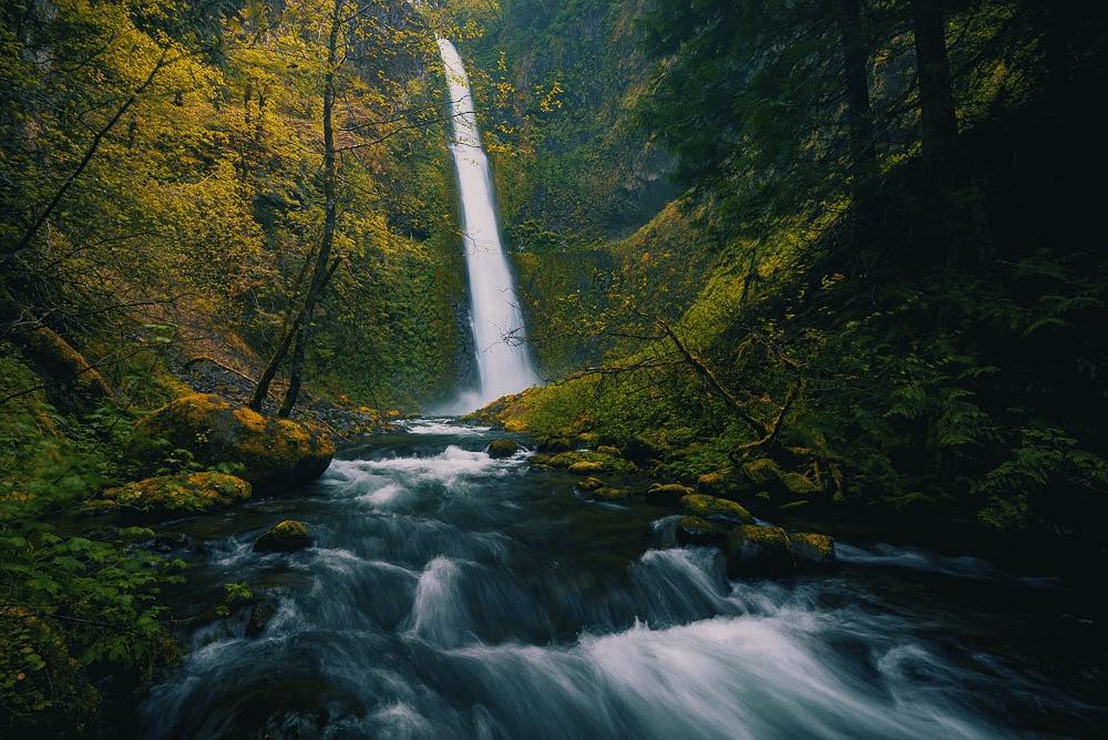
Tamanawas Falls
Located on the eastern side of Mount Hood, this 100-foot falls is fed by Cold Spring Creek, which flows from the glaciers of Mount Hood, ensuring a steady and robust flow of water throughout the year. The winding 3.8-mile round trip to it on the Tamanawas Falls Trail is relatively easy, well-marked and maintained as it follows along the creek.
The trailhead is located off Oregon Highway 35, making it easily accessible for visitors traveling from the Portland area or the Gorge. The trail begins with a gentle ascent through a dense forest of Douglas fir, western red cedar, and hemlock, extending a cool and shaded path during warmer months.
The trail crosses several footbridges and passes by smaller cascades and pools. The forest is home to a variety of plant and animal species, and hikers may enjoy the sight of wildflowers, ferns, and possibly even wildlife such as deer or endemic bird species.
As you near the waterfall, the sound of the rushing water grows louder, and the trail opens up to reveal a fabulous view of the falls as it cascades over a basalt cliff and into a large, clear pool.
The area around the base of the falls is spacious, allowing visitors to explore and find their perfect spot to take in the view. The mist from the falls creates a refreshing atmosphere, especially on hot summer days.
The trail to Tamanawas Falls connects to other trails in the Mount Hood National Forest, providing opportunities for longer hikes and exploration of the area’s diverse terrain.
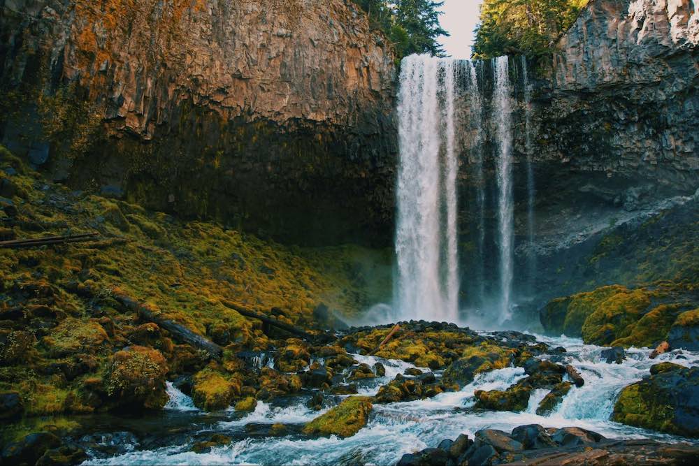
Umbrella Falls and Sahalie Falls
These two falls are located on the slopes of Mount Hood. Umbrella Falls is known for its unique umbrella-like shape, while the thunderous Sahalie Falls is surrounded by mossy rocks. Both can be accessed via a network of trails that crisscross the Mount Hood National Forest and provide intimate encounters with alpine meadows and forests as well as other waterfalls.
Umbrella Falls is named for its resemblance of an open umbrella as it descends a rocky slope and opens into a veil spreading widely at the base. The hike to it begins at the Elk Meadows Trailhead and is an approximate 4-mile moderate round trip. The trail is well-maintained as it leads through forests and wildflower-filled meadows with views of Mount Hood and the surrounding landscape. During summer months, the meadows are bursting with colorful wildflowers.
Sahalie Falls, not to be confused with the waterfall of the same name in the Willamette National Forest, is known for its heavy flow as it plunges down a steep cliff into a mossy, rocky basin below. The trail to it, which begins at the same trailhead as Umbrella Falls, is relatively short and easy, making it accessible for hikers of all ages and abilities and allowing them to explore both falls in a single hike.
The area around Sahalie Falls is rich with vegetation, including ferns, mosses, and various alpine plants that thrive in the moist environment. The falls are particularly impressive during the spring and early summer when the snowmelt from Mount Hood increases the water flow.
In addition to the natural beauty of the waterfalls, the surrounding area provides numerous recreational opportunities. Visitors can enjoy picnicking and wildlife watching and, in the winter months, snowshoeing and cross-country skiing. The proximity to Mount Hood also means that visitors can combine their waterfall hike with other activities such as climbing, skiing, or simply enjoying the alpine scenery.
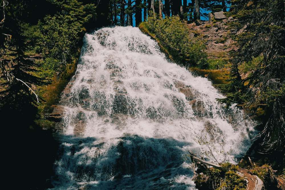
Ramona Falls
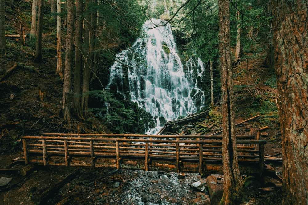
One of the more visited waterfalls by hikers in the Mount Hood National Forest, Ramona Falls tumbles 120 feet down a series of basalt steps, creating a veil-like effect.
Situated near the Sandy River on the western flanks of Mount Hood, the hike to it begins at the Ramona Falls Trailhead, which is accessible via the Lolo Pass Road. The 7.2-mile round-trip is moderate in difficulty and passes through old-growth forests. The trail follows the Sandy River for the first portion of the hike. Hikers must cross the river, which can be challenging, especially during the spring and early summer when the water level is high due to snowmelt. A makeshift log bridge is often in place, but hikers should use caution and check trail conditions before setting out.
After crossing the river, the trail meanders through a dense forest of Douglas fir, western hemlock, and cedar. These provide ample shade, making the hike pleasant even on warm days. The forest floor is covered with ferns, mosses, and wildflowers.
There are several viewing areas around the base of the falls, with benches and logs where hikers can sit and enjoy the scenery. The area is a popular spot for picnicking, and many hikers take the opportunity to rest and have lunch while taking in the beauty.
The hike is a loop trail, with the return route offering different views and experiences. The trail passes through a different section of forest with a diversity of landscape and changing scenery, and with more wildflowers and occasional glimpses of Mount Hood.
Little Zigzag Falls
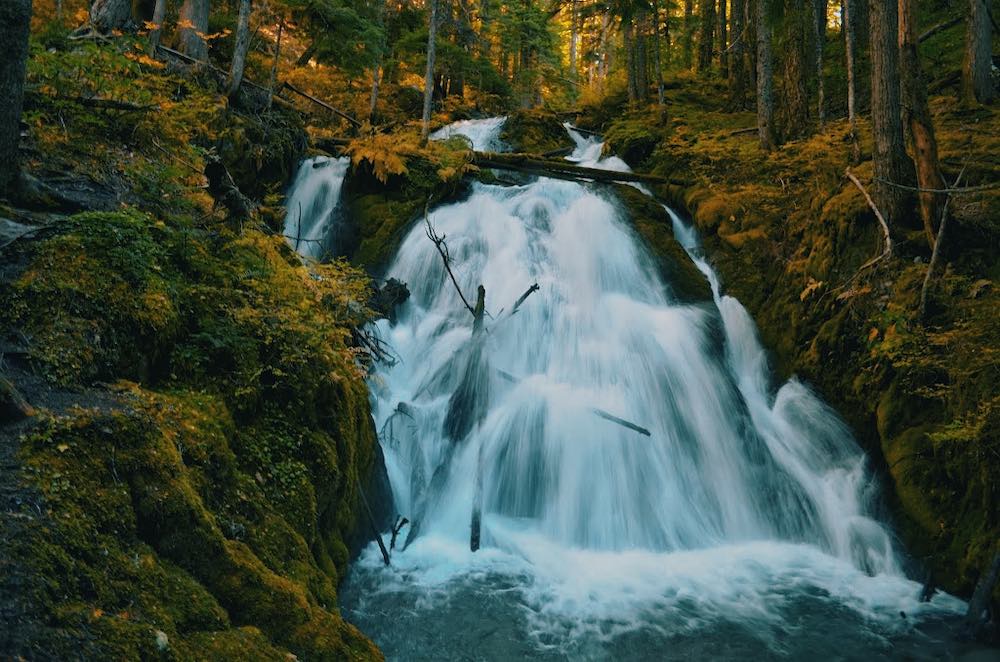
Little Zigzag Falls is located along the Little Zigzag River in the Mount Hood National Forest, just a short drive from the popular ski resort town of Government Camp.
The short, easy trail to these falls is easily accessible from U.S. Highway 26, making it a convenient stop for for families with young children or those looking for a quick, scenic outing while exploring the Mount Hood area. The hike is less than a mile round trip, with minimal elevation gain as it follows the course of the Little Zigzag River, a gentle mountain stream that wanders through a dense forest of Douglas fir, hemlock, and cedar.
The path is well-maintained and shaded for a cool and pleasant hike even on warm summer days. Along the way, hikers will pass through patches of ferns, mosses, and wildflowers.
These falls are not particularly tall, but their charm lies in how they cascade gently over a series of rocky steps into a clear pool framed by an abundance of moist greenery. The area around the base is spacious and inviting, with several spots to picnic or just sit and enjoy the view, while the clear pool is a great spot in which to wade.
In addition to the hike to Little Zigzag Falls, the surrounding area in the Mount Hood National Forest offers several other recreational opportunities. The nearby Zigzag Ranger Station provides information on additional trails and points of interest. Visitors can also explore the historic Barlow Road, a segment of the Oregon Trail that passes through the area, presenting a glimpse into the history of the region’s 19th century immigrants.
White River Falls
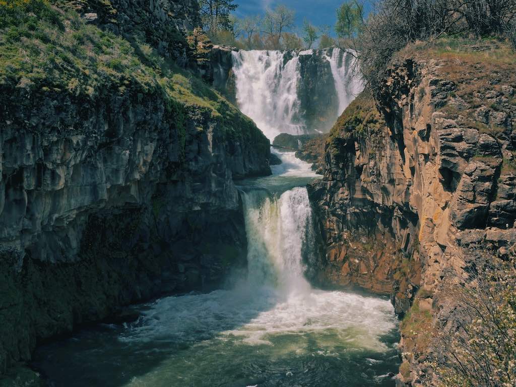
Located a bit further out into the dry side of north-central Oregon, the White River Falls are located within the White River Falls State Park, about 35 miles southeast of The Dalles, which is a town on the Columbia River directly east of the town of Mosier. They can be accessed by driving south from The Dalles on U.S. Route 197, then east on Highway 216. The drive takes visitors through the grassy rolling hills and farmland typical of the region, in stark contrast to the thickly-forested greenery found in the western part of the state.
The park encompasses an area where the White River drops dramatically over a series of basalt cliffs, creating a multi-tiered display. The first and most impressive 90-foot plunge is captured by a deep canyon and is followed by two smaller drops as the river continues its journey.
The park provides picnic areas equipped with tables and grills, trails and sandy swimming spots at the base of the falls, making it great for a day trip.
Several trails wind through the park, offering various vantage points to the falls and surrounding landscape. A short trail leads from the parking area to the main viewpoint, where visitors can get a close-up look at the impressive first drop of the falls. For a more extended hike, the trail continues down into the canyon, allowing for exploration of the lower tiers of the falls as well as access to the swimming areas at the foot of the falls.
Visitors can explore the remnants of the historic White River Powerhouse which still stand before you get to the swimming beach. Built in the early 20th century, the powerhouse was the one of the first in Oregon to generate electricity, supplying electricity to The Dalles. Although it ceased operation in the 1960s, its ruins add an intriguing historical element to the park. Interpretive signs provide information about the history and significance of the site.
Wildlife enthusiasts may also enjoy the diverse flora and fauna found in the park. The arid environment supports a variety of plant species adapted to the dry conditions, while the river and canyon provide habitat for birds, mammals, and other wildlife. Birdwatchers can often spot species such as ospreys, kingfishers, and various songbirds in the area.
Washington’s Waterfalls Near Portland
Moulton Falls and Yacolt Falls (Washougal River)
Located along the Washougal River, Moulton Falls and Yacolt Falls can make for a pleasant day trip. Several small cascades and swimming holes populate the scenic area, all accessible via easy, well-maintained trails.
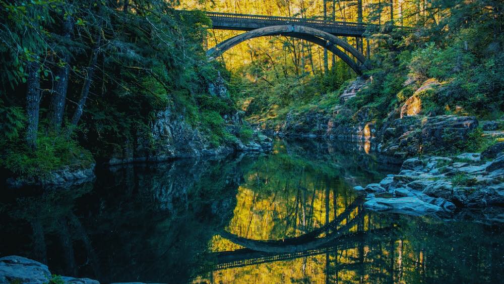
The falls is situated within the Moulton Falls Regional Park, in Clark County, Washington, just a short drive from Portland. The park spans over 387 acres and includes a variety of recreational opportunities, including hiking, picnicking, and swimming
The highlight of Moulton Falls Regional Park is the Moulton Falls Bridge, an historic arch bridge that spans the Washougal River and exposes views onto several small waterfalls and cascades.
The trails in the park are well-marked and suitable for hikers of all skill levels. The Moulton Falls Trail is a particularly popular route, offering a gentle hike along the river with access to several scenic viewpoints. The trail connects to the Bells Mountain Trail and the Tarbell Trail, providing options for longer hikes
Falls, also known as the Yacolt Creek Falls, is another beautiful spot located within the park, accessible via a short hike from the main parking area.
Both Moulton Falls and Yacolt Falls are popular swimming spots during warmer months. The clear, cool waters of the Washougal River provide a refreshing escape from the summer heat, and the natural swimming holes are safe and enjoyable for visitors of all ages. The park also features several picnic areas with tables and benches.
In addition to its natural beauty, Moulton Falls Regional Park is rich in history. The area was once inhabited by Native American tribes, and remnants of their presence can still be found in the form of petroglyphs and other artifacts. The park also played a significant role in the logging industry during the early 20th century, and remnants of old logging equipment and structures can be seen along the trails.
Lower Lewis River Falls
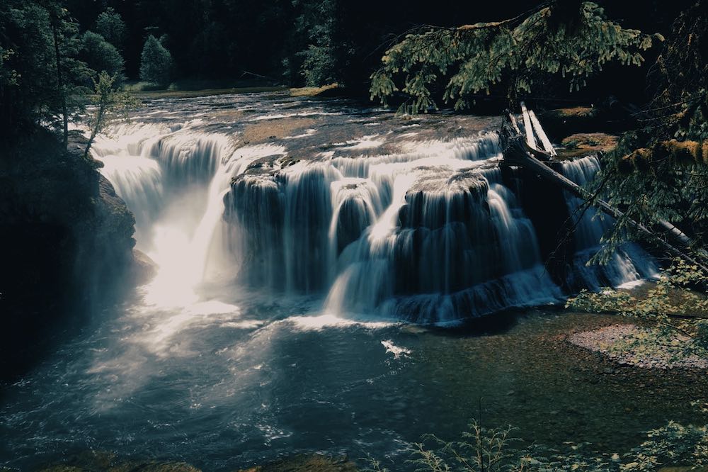
A magnificent waterfall, Lower Lewis River Falls drops 43 feet in a wide, curtain into an expansive pool below. The pool is perfect for swimming, the space around it is ideal for picnicking, and the surrounding trails provide awe-inspiring views of the falls and the lush forest.
The falls are situated along the Lewis River, a major river in southwestern Washington that flows through a series of scenic landscapes before joining the Columbia River.
The river and falls are located in the Gifford Pinchot National Forest, a vast and diverse protected expanse that encompasses over 1.3 million acres of dense forests, volcanic peaks, rugged mountains, and numerous pristine waterways. The forest is named after Gifford Pinchot, the first Chief of the United States Forest Service and a pioneering conservationist.
The 8.8-mile round trip trail to the falls is accessible from the Lower Falls Recreation Area, which provides ample parking, picnic areas, and restroom facilities. It is well-maintained and relatively easy. The path winds through Douglas fir, western red cedar, and hemlock, with occasional glimpses of the river and surrounding landscape.
As you approach the falls, the sound of rushing water grows louder, and the forest opens up to reveal them. They are notable for their wide, curtain-like appearance, with water cascading over a broad basalt ledge into a large, clear pool below. The pool is a popular spot for swimming and wading, especially during warmer months, and the cool, refreshing water provides a perfect way to beat the summer heat.
The area around the falls is equipped with several picnic tables and benches. Several trails in the area allow additional opportunities for hiking of varying levels of difficulty and length. The Lewis River Trail follows the river upstream and downstream from the falls, providing access to other scenic spots, including Middle Falls and Upper Falls.
The clear, cold waters of the river is home to a variety of fish species, including rainbow trout, cutthroat trout, and steelhead. The falls are particularly photogenic in the early morning or late afternoon when the light is soft and creates beautiful reflections on the water.
Spirit Falls
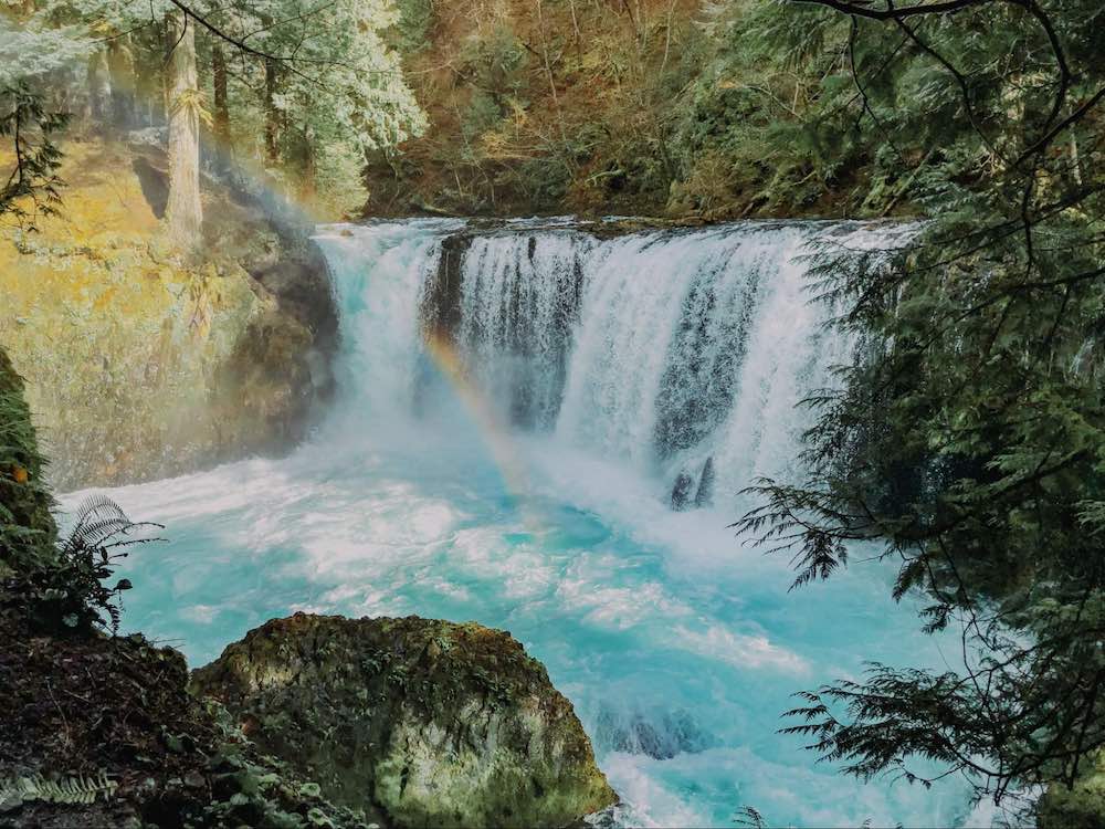
Located in southwestern Washington in a remote and rugged section of the White Salmon River and accessible only to kayakers and hardy hikers, Spirit Falls drops 33 feet into a pool at the bottom of a narrow canyon. What makes it such a glorious sight to behold is the brilliant, clear turquoise color of the water caused by the high mineral content in the river.
The trailhead leading to the site is located near the town of Cook, Washington. The hike is short but challenging, as it involves navigating through dense forest and rocky terrain and requires a steep, uneven descent into the canyon. Hikers should be prepared with appropriate footwear and exercise caution.
The White Salmon River is renowned for its clear, glacial-fed waters, challenging rapids, and technical sections for kayaking, and Spirit Falls is one of the highlights of an adrenaline-pumping adventure. Experienced kayakers navigate the powerful drop, showcasing their skills and enjoying the thrill of the descent. The falls are often featured in kayaking videos and photographs, highlighting the daring feats of those who take on the challenge.
For those who prefer a more leisurely experience, the area around Spirit Falls offers several spots to sit and enjoy the natural beauty.
In addition to Spirit Falls, the White Salmon River area offers numerous recreational opportunities. Visitors can explore other nearby waterfalls, hike along the river, or enjoy a scenic drive through the Gifford Pinchot National Forest. The town of White Salmon, located nearby, provides amenities such as lodging, dining, and local shops, making it a convenient base for exploring the region.
Husum Falls
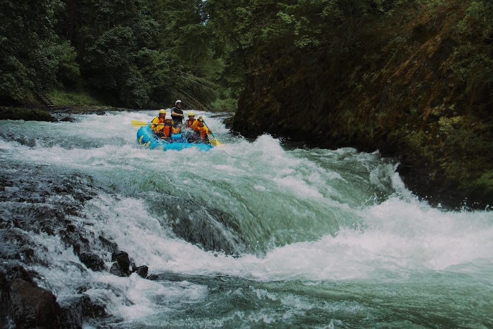
Husum Falls is another popular whitewater spot on the White Salmon River. Its 10-foot descent is brief but intense, thus attracting thrill-seekers from all over to experience plunging in rafts into the churning waters below.
The falls is located near the small town of Husum in Klickitat County. The river flows from the glaciers of Mount Adams, carving its way through deep canyons and lush forests before joining the Columbia River. The surrounding area offers beautiful views of the river and the rich, forested landscape.
Several local outfitters offer guided rafting trips on the White Salmon River, with most trips including a run over Husum Falls as one of the most commercially-rafted falls in the United States. These guided trips provide all necessary equipment and safety instructions, ensuring that even first-time rafters can safely enjoy the excursion. The guides are highly experienced and knowledgeable about the river, offering tips and insights to make the trip both exciting and informative.
In addition to the excitement of the falls, the surrounding area offers stunning natural beauty. The White Salmon River winds through an unspoiled green canyon, with towering trees and dense undergrowth creating a picturesque backdrop. Rafters can enjoy the scenic views and the abundant wildlife, which includes birds such as ospreys and eagles, as well as various fish and other river creatures.
The area around Husum Falls is also popular for other outdoor activities. Hiking trails in the vicinity provide opportunities to explore the beautiful forested landscape and enjoy views of the river from different vantage points. Photographers are drawn to Husum Falls for its dramatic scenery and the opportunity to capture action shots of rafters navigating the falls.
The area around Husum Falls also offers spots for those seeking a more relaxed experience, to picnic and enjoy the peaceful sounds of the river.
Rodney Falls and Pool of the Winds
Located on Hamilton Mountain in Beacon Rock State Park, which is located on Highway 14 on the Washington side of the Columbia River Gorge, Rodney Falls consists of a cascading flow, while the Pool of the Winds is a rock formation directing the river flow down into a small, enclosed pool.
The trailhead to Hamilton Mountain, which on the way passes by Rodney Falls and Pool of the Winds, is located just up the road from Beacon Rock, and it extends high-up views over the Gorge, the Bonneville Dam, and other peaks in the distance. The falls are approximately 2 miles in, making for a 4-mile round trip. The trail is well-maintained, with some steep sections and rocky terrain. Hikers should be prepared with sturdy footwear and sufficient water.
As you ascend, you’ll be treated to views of the Gorge and the surrounding forest. The trail winds through dense stands of Douglas fir and western red cedar. Along the way, you’ll also pass several rugged cliffs with vistas over the Columbia
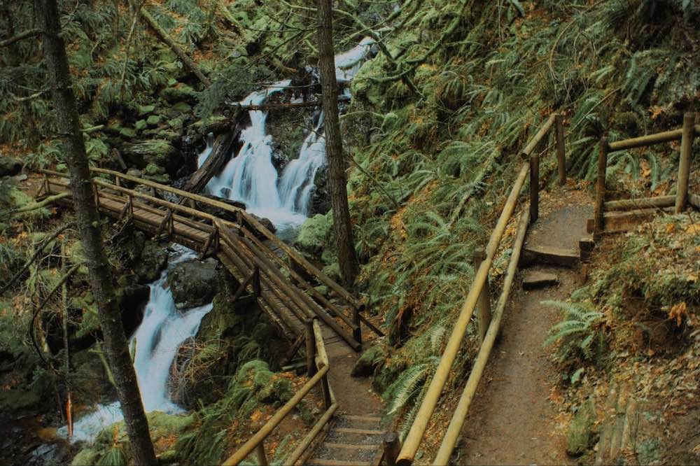
Rodney Falls is the first major landmark along the trail. It is composed of a series of cascades that flow down a rocky slope. A wooden footbridge crosses the stream just below the falls, providing an excellent vantage point for viewing and photographing the cascade
Continuing up the trail, you’ll soon reach the Pool of the Winds. Here, the water from Rodney Falls plunges into a small, enclosed pool. The pool is named for the swirling winds created by the falling water, which can be felt as you stand near the edge. The enclosed characteristic of the pool and the force of the water create a mesmerizing, almost magical sight.
The cool, damp stony environment around the Pool of the Winds is rich with diverse array of flora, including ferns, mosses, and various alpine plants. The hike to it is particularly rewarding in the spring and early summer when the water flow is at its peak, and the surrounding vegetation is vibrant and green.
The trail continues beyond Rodney Falls and Pool of the Winds, offering additional hiking opportunities and even more spectacular views. The trail eventually reaches the summit of Hamilton Mountain, where hikers are rewarded with sweeping vistas of the Gorge, Mount Hood, and landscapes below.
Panther Creek Falls
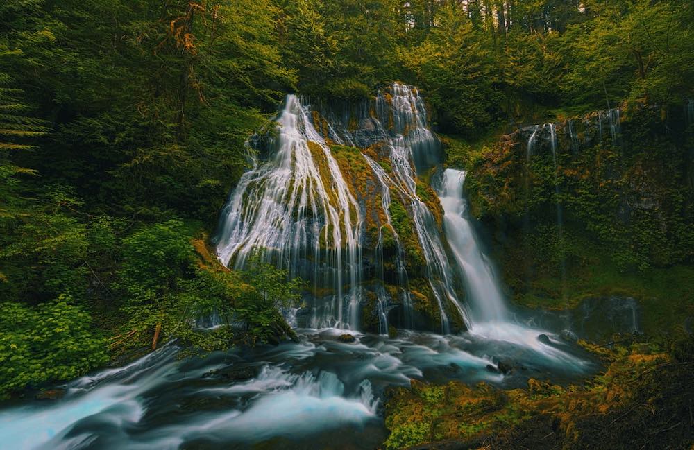
Located near the small town of Carson in southwestern Washington, Panther Creek Falls delights the visitor with its 130 foot drop that then spreads out in multiple cascades over a series of rocky ledges covered in bright green moss.
They are located in the Gifford Pinchot National Forest, and they are reached by a short trail, less than a mile round trip. The trailhead is easily accessible via Forest Road 65, also known as Wind River Highway. Despite its brevity, the trail offers a rewarding experience as it winds through a deep forest that feels almost enchanted.
The viewpoint for the falls is located on a wooden platform that provides a safe and excellent vantage. From this platform, visitors can see the upper and lower tiers of the falls, as well as the moist vegetation that surrounds them.
The forest is home to towering Douglas firs, western hemlocks, and cedars, as well as a variety of ferns, wildflowers, and mosses. Birdwatchers can often spot species such as the American dipper, which frequents the area around the falls, as well as other forest birds.
For those looking to extend their adventure, the Gifford Pinchot National Forest offers numerous other trails, camping, and other points of interest, including the Wind River, the historic Carson Hot Springs, the scenic Trout Lake, and the expansive Mount St. Helens National Volcanic Monument and Mount Adams Wilderness.
Langfield Falls
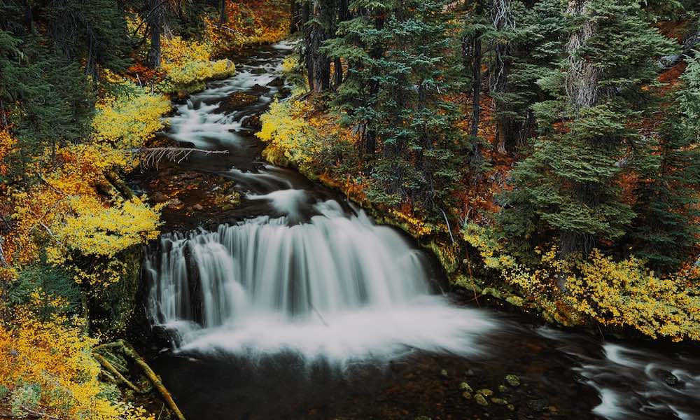
Langfield Falls is another multi-tiered beauty, dropping over a series of rocky ledges and flowing in different directions into a clear pool below. It is located within the Gifford Pinchot National Forest at the base of Mount Adams, near the small community of Trout Lake
The Langfield Falls Trail is accessed off Forest Road 23, and it is well-maintained and relatively short and easy, making it an ideal choice for a family outing or a quick nature walk. The path winds through a green forest of Douglas fir, western hemlock, and other native trees.
The viewing area near the base of the falls provides an excellent vantage point to admire and photograph Langfield Falls. The area around the falls is also rich in plant life, with various ferns, wildflowers, and mosses.
Langfield Falls is particularly beautiful in the spring and early summer when the water flow is at its peak and the surrounding vegetation is lush and vibrant. In addition to its natural beauty, The falls are also of geological interest, being located on a basalt cliff, which was formed by ancient volcanic activity in the region.

Falls Creek Falls
At 200 feet, Falls Creek Falls is one of the tallest in the region. A three-tiered spectacle, it is reached by a 6.1-mile hike through a beautiful forest.
The trailhead is accessible via Forest Road 3062 in the Gifford Pinchot National Forest, near the town of Carson, Washington. The trail is well-marked and popular among hikers of all skill levels, though it is considered moderately difficult due to its length and elevation gain. The trail follows the rushing Falls Creek and crosses it several times on wooden footbridges as it winds through a dense forest of Douglas fir, western hemlock, and red cedar, with an understory of ferns, mossy rocks, and wildflowers. Wildlife is abundant in this area, and hikers may spot deer, elk, and various bird species along the way.
About halfway to the falls, the trail opens to a viewpoint of the surrounding forest and the distant mountains. The final section of the trail includes a series of switchbacks that ascend to the base of the falls, where you’ll be rewarded with a close-up view of them.
The upper tier is the tallest, with water plunging over 80 feet into a rocky pool. The middle tier supports a wider cascade that fans out over a series of ledges, while the lower tier is a smaller but equally picturesque drop into a tranquil pool.
The base of the falls is a popular spot for picnicking and relaxation. There are several large rocks and logs near it where hikers can sit and enjoy the view, as well as plenty of shaded areas for a quiet rest.
In addition to its natural beauty, Falls Creek Falls is also an excellent destination for those interested in geology. The falls are formed by the erosion of volcanic rock, and the unique rock formations around them provide a fascinating glimpse into the geological history of the area.
Preparing for Your Visit
Activity-Based Recommendations
For active visitors, an abundance of hiking trails provide access to many of these waterfalls near Portland, such as the Angel’s Rest Trail and the Silver Falls State Park’s Trail of Ten Falls outside of Silverton, Oregon. These trails range in difficulty and length, catering to both novice hikers and seasoned adventurers.
Waterfall Safety Tips
When visiting waterfalls, safety is paramount. Ensure you wear appropriate footwear, stay on marked trails, and keep a safe distance from the edge. Always check weather conditions before heading out and bring plenty of water and snacks.
Seasonal Waterfall Visits
The best times of year to visit Portland’s waterfalls vary depending on what you’re looking for. Spring and early summer provide the most robust water flows as well as an abundance of mist, which contributes a mystical quality. Autumns are great for enjoying the changing colors of the foliage. Winter visits can be magical, with the possibility of seeing the falls partially frozen. For serious photographers, mornings or late afternoons are best, as the light is softer and creates a more dynamic and colorful scene. These times are also when there are fewer other visitors.
Regardless of when you visit, all of these waterfalls are a testament to the natural wonders of Oregon and are sure to leave a lasting impression on everyone who comes to view them.
Honoring The Region’s First Inhabitants
The area surrounding all these magnificent falls is valued for its rich cultural history, with several Native American tribes having inhabited the region and stewarded its natural resources for millennia.
Where to Stay
Portland Eco House
After a day of chasing waterfalls, enhance your adventures by staying at the Portland Eco House, a charming, earth-friendly, vegan-friendly guesthouse located in the Alberta Arts District and just a short drive from the Columbia River Gorge and its many waterfalls.
Choose from stylishly appointed rooms in the main house, a private patio cottage, or a cozy patio suite, all featuring organic bedding and eco-conscious amenities.
Unwind in the lovely patio or by the fire pit, knowing your stay supports sustainable lodging. With its beautiful decor and commitment to environmental responsibility, the Portland Eco House is the perfect base for exploring the Gorge’s hidden waterfall treasures.
From the delicate tiers of Fairy Falls to the powerful plunge of Elowah Falls, Portland’s hidden waterfalls serve up an intimate encounter with nature. Lace up your hiking boots, grab a map, and set out to explore these lesser-known cascades. With the welcoming Portland Eco House awaiting your return, you can turn your waterfall adventure into a perfect weekend getaway. Happy trails!

Stayed a week at Scott’s place and can’t recommend it enough. Scott was a very friendly, accommodating, and responsive host, and the lodgings were more than perfect for my needs, and exactly as described.
If I find myself in Portland again, I will definitely be checking to see if Scott’s place is available.

Portland Vintage Shopping: 27 Spots to Score the Best Deals
[pac_divi_table_of_contents default_state="closed" icon_position="left" exclude_headings_by_class="on" included_headings="off|on|off|off|off|off" level_markers_1="icons" icon_marker_1="E||divi||400" level_markers_2="icons" icon_marker_2="E||divi||400"...

Roasted in Rose City: A Tour of Portland’s 20+ Top Coffee Shops
[pac_divi_table_of_contents default_state="closed" icon_position="left" exclude_headings_by_class="on" included_headings="off|on|off|off|off|off" level_markers_1="icons" icon_marker_1="E||divi||400" level_markers_2="icons" icon_marker_2="E||divi||400"...

Read Local: Venture Inside Portland’s Literary Arts Scene
[pac_divi_table_of_contents default_state="closed" icon_position="left" exclude_headings_by_class="on" included_headings="off|on|off|off|on|off" level_markers_1="icons" icon_marker_1="E||divi||400" level_markers_2="icons" icon_marker_2="E||divi||400"...

18 Unbelievably Weird Museums in Portland to Explore
Curious traveler, if you’re drawn to the weird, wacky, and wonderfully eerie, Portland is calling your...

20 Best Wellness Retreats in Portland: Feel the Difference
[pac_divi_table_of_contents icon_position="left" exclude_headings_by_class="include" included_headings="on|on|on|on|on|off" level_markers_1="icons" level_markers_2="none" level_markers_3="none" level_markers_4="none" level_markers_5="none"...

Join in the Festive Spirit of Portland’s Winter Celebrations
Against the backdrop of the snow-capped Cascade Mountains, Portland winters sparkle with...
Sip and Savor: The 16 Best Tea Houses in Portland
[pac_divi_table_of_contents default_state="closed" icon_position="left" exclude_headings_by_class="on" included_headings="off|on|off|off|off|off" level_markers_1="icons" icon_marker_1="E||divi||400" level_markers_2="icons" icon_marker_2="E||divi||400"...

Shop Green in Portland: Eco-Friendly Stores You’ll Love
Portland, Oregon, is a haven for sustainable shopping, with plenty of local stores offering ethically-made and environmentally-friendly products for customers dedicated to green living. If you’re an eco-conscious consumer, you’ll love exploring the best places to...

Ghostly Adventures: Portland’s Most Haunted Locations
Whispers in the dark… footsteps that aren’t there… Halloween is just around the corner, and Portland’s spirits are restless! Are you ready for a ghostly adventure? Portland isn’t just known for its quirky charm and vibrant culture but also for being a hotspot for...

Amazing Local Artisans abound at Portland Saturday Market
If you’re visiting Portland, you absolutely have to check out the iconic Portland Saturday Market. It’s the largest continuously operating open-air arts and crafts market in the country, and it’s packed with incredible local artisans and makers. Spend a day browsing...

